|
|
| Geoffrey Hastings, William C. Slingsby,
Walter Perry Haskett-Smith (UK)
and Elias Hogrenning (N) climbed nearly all of them in July 1898. It is
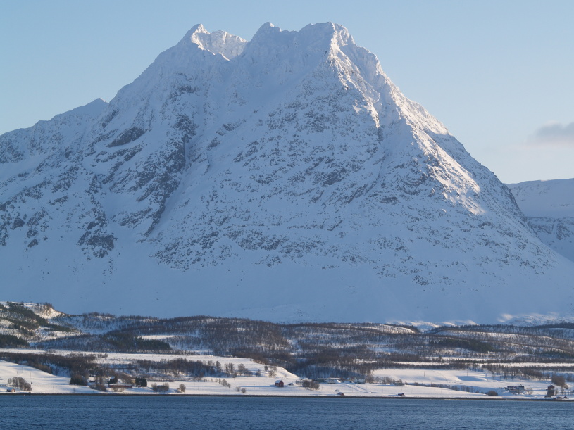
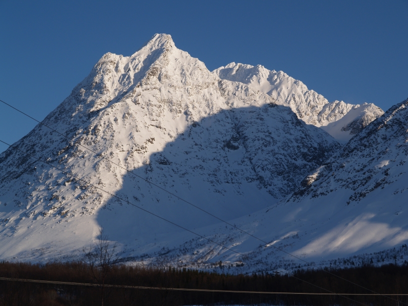
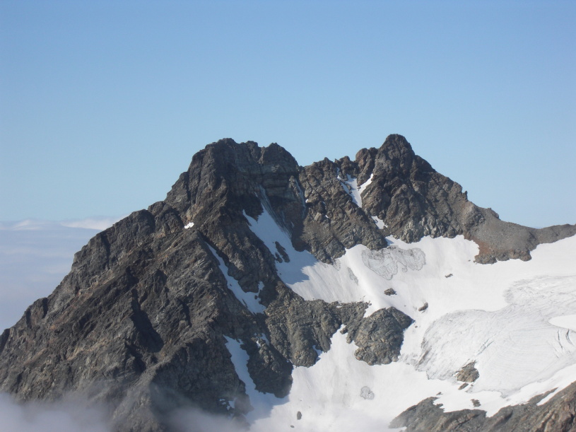
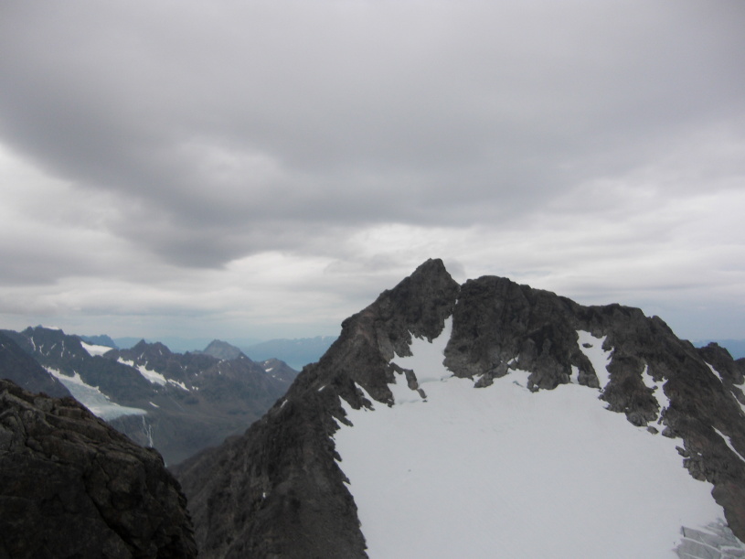
uncertain if any of them were first ascents. The Isskartinder. "From our camp at Jægervand a range of four principal and several minor peaks, the Isskartinder repeatedly beckoned to us. The third highest had been climbed by an officer and our frend Red Shirt who proudly pointed out to us the cairn which he had built. What a jolly day three of us had up there, in spite of the rain ! Did we not climb two new peaks, and cross two new glacier passes? We climbed two peaks, because we were uncertain which of two was the higher; we call the pass beneath the highest peak Tvivlerensskar, or the Doubter’s Pass, on account of our doubts. Let me transport you to a ridge 25 ft. below the top of the eastern peak. In front andabove was a huge slab, where there was one great crack, which did not come down to the ridge, but to the head of a fearful cliff. It was probably feasible. We preferred the better part of valour, and descended about 100 ft. on the snowy ledge up which we had come to a place where there was a split block in a corner of a vertical face about 20 ft. high - a place almost exactly like the so-called East Pisgah climb on the Pillar Rock. Clearly this was the place for Haskett-Smith; in fact, it might have been made for him, and Hogrenning and I much enjoyed seeing him overcome the difficulties, which were by no means small. The wedged stone in the Pisgah climb was absent, otherwise the similarity was complete. Rucksacks and axes were hoisted up, and for that matter so were two human burdens. A series of broad, gently inclined slabs, curiously and deeply cracked here and there, soon led us to a model top where, in process of time, a huge cairn was erected, As the top is not unlike the brow or stem of an old viking ship, I have taken the libertyof giving the mountain the name of ,Hringhorn,’ or Baldur’s Ship. The view was superb; but it was clear that we were only on the second highest. A treble- peaked mountain in the same range - now called Tre Gygre*, or Three Witches - looked very grand. It was climbed a few weeks later by Mrs. Main. How well Hogrenning led up the steep aréte of the highest peak, and what a jolly glissade we had down the big central gully! Then, too, think of our new pass - the Isskar - which gives its name to the range: no carelessness allowable here amongst the big séracs. ‘Anchor well in that ice, while I cut steps across to the rock.’ ‘More rope do you say? Well, you cannot have more than 4 ft.” I must have 10 ft. Slowly, cautiously, and surely our leader reaches the rock. There is but a 2-in. crack in it; and on him (Hogrenning) for 5 min. devolves all the responsibility. Look at him, firm as the rock itself. We are off the glacier on a terrace, 1, 200 ft. from the base of the gorge below. There is one feasible route - but feasible only for a madman - almost under the glacier itself, whichterminates on the brow of a cliff. No, no, no! The terrace leads us to a lateral gorge. Hideous ! We must descend to the main gorge down the rock wall itself, and within rather narrow limits, too. Hogrenning led us, step by step, up, down and across, most cleverly, principally down a huge boss of rock. We were only half an hour in descending; but who knows how much that half-hour meant? This cliff, coped with ice, is a conspicuous object from the W., and is well named Isskaret, the Ice Gap. We arrived in camp at 10 o’clock, and, in spite of unfavour- able weather, had had one of the most successful expeditions during our campaign." * Brevasstinden (William C. Slingsby: Mountaineering In Arctic Norway, Alpine Journal 1899.) |
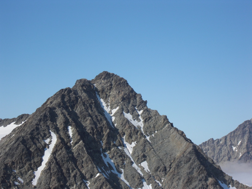
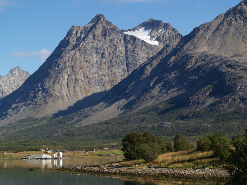
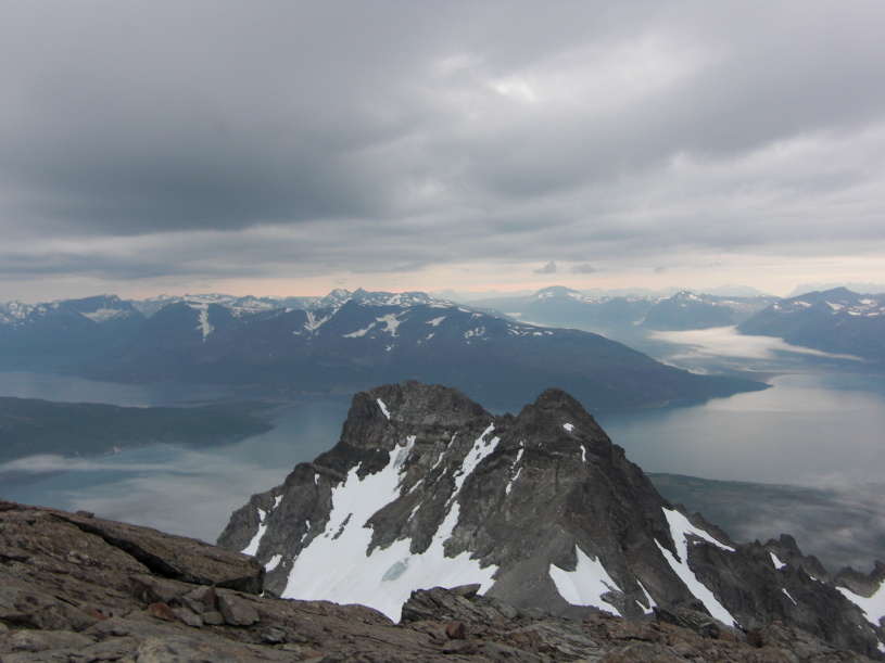
| Elizabeth Main (a.k.a. Mrs.
Aubrey
Le Blond), Emil Imboden and Josef Imboden climbed the East ridge (the right hand
skyline) of Trollvasstinden on July 26th 1898. They found
a big cairn on the topmost point which
they reached at 7:30 a.m. "When near the head of the valley we thought to shorten our way by striking up to our left across stones to a little saddle overlooking a half-frozen lake and in full view of our peak. Very far away it looked across the hollow and beyond the glacier which descends from the base of the cirque of which the Iss- kartind forms part. Formidably steep it was too, and streaked with great snow couloirs, seamed here and there by falling stones, so the mountain appeared as if it might not be an unmixed joy to go up. We sat down, got out the Zeiss glasses and saw something much worse than steep couloirs and precipitous rocks, and this took the shape of a big cairn on the topmost point. "Never mind!" said I. "It is a peak worth doing, even if we are the second party up it." "We shall, at any rate, ascend by a new route," remarked Imboden. "Which ridge do you propose trying?" I enquired, for I know that if it is a choice between a snow couloir and a rock ridge, we nearly always take the latter. "The one to our right," Imboden replied; "and I shall try and follow it to the top." I must here explain that from where we stood this ridge looked as if it was one of the great main ridges of the mountain. In reality, it was not very pronounced, the chief ridge on that side rising direct from the snowy pass between the highest peak of the Isskartinder and the eastern peak. The latter is very easy, and was ascended some years ago for the survey of this district, on which the map now in preparation will be based. We traversed snow-slopes from our little pass, mounted stones beyond, and were soon on the great plateau of the Isskar glacier. It was now about 5.30 a.m.. and the heat was very great. I liked the look of the ridge as we approached it. It led straight to the summit, and though the upper part seemed extremely steep, it was obviously possible to skirt it on the snow. To make a long story short, we picked our way up broken rocks with little trouble till we reached the foot of the final tower which forms the actual summit of the mountain. To our right, smooth and vertical cliffs barred the way. To our left, the rock was more split up, and after wriggling to the top of a chimney or two, and hoist- ing ourselves up some slabs, we commenced a traverse, and having gone some distance doubled back at a higher level and regained the ridge. From here the few steps which remained were disclosed, and proved to be quite easy, and at 7.30 a.m. we stepped on to the top and had the world for miles around at our feet. If the view from the Kjostind was the loveliest of its kind I had ever seen, I must admit that it was excelled by that from the Isskartind. Straight below us lay the tran- quil blue waters of the Jaegervand. The sea beyond, studded with islands, shimmered in the brilliant light of a perfect summer's day. Beyond the Kjosenfjord, spotless robes of snow covered the mountains. Glaciers with green rifts in their waves of ice swept majestically between the peaks, which stood like minster spires to the north. Tiny lakes looked up at us with wide-open sapphire eyes from every little hollow. Clouds drifted lazily here and there, casting deep purple shadows on the hill-sides. Not a sound fell on the ear. We seemed detached from the earth." (Mrs. Aubrey Le Blond: Mountaineering In The Land of the Midnight Sun, 1908) |